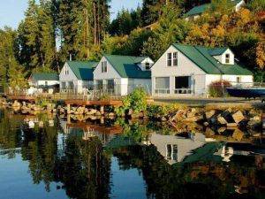
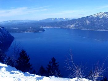
 The vibrant community of Bayview is located at Scenic Bay at the south end of Lake Pend Oreille. Bayview can be accessed by turning east onto State Hwy 54 at Athol. This is also the start of the International Selkirk Loop’s South Lake Super Side Trip. Towering mountains and steep, rocky cliffs around Bayview have become a haven for mountain goats, eagles and other alpine wildlife. Surrounding Bayview is 4,180 acre Farragut State Park – Idaho’s second largest State Park. Bayview is a favorite location for sailboat moorage. The bay is also home to several float-house communities, which lends a feeling of an ocean-side resort to the area.
In the early 1840’s Bayview was originally called Squaw Bay. Squaw Bay, at this time, was made up of just a few fur trappers’ cabins and some tents. Those old mountain men, a few Englishman but mostly Frenchman from New France (Canada), would trap the rivers and streams of the northern Columbia area for the Hudson Bay Company or American Fur Company or the North-West Company, all of which had trading posts established in the area. There were also a handful of Jesuit missionaries working with the native Indian tribes.
 The next fifty years saw a slow but steady growth in the Columbia regions. Squaw Bay continued to be a wintering place for trappers. On July 2, 1864, President Abraham Lincoln signed an Act of Congress creating the Northern Pacific Railroad Company.
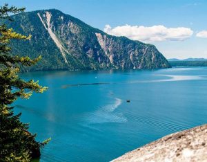
The first true settlement at the south end of the Lake Pend Oreille was Pend Oreille City, which appeared in 1864-65 at the southern most tip of the lake at what is now known as Buttonhook Bay. See the historical marker commemorating the site on your way to Bayview on Hwy 54. It was the second white settlement in north Idaho – the first being Seneaqueteen on the Pend Oreille River. Pend Oreille City was founded by Zenas Moody and was an overnight stop for miners and freight merchants using the Lake Pend Oreille – Clark Fork River route, also known today as the Pend Oreille National Scenic Byway, to the northeastern gold mines.
 Lake travel originated in 1866 following the construction of Captain Moody’s steamboat, the Mary Moody (named after his wife). This steamboat transported miners up the lake to connect with the Wild Horse Trail heading to the Wild Horse Mines in British Columbia or up the Clark Fork River toward Helena and the Last Chance Gold Mines of Montana. The Mary Moody could hold 55 passengers, 85 mules, and 10,000 pounds of freight at a cost of 13¢ a pound. Sometime after the 1880’s the focus shifts to Squaw Bay as the major settlement at the south end of the lake – probably due to the start of increased logging business.
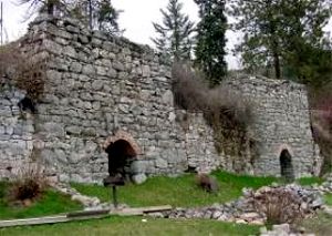
Today, along one side of the bay you’ll notice a rock structure comprised of separate cells with small doors in front. These are the remains of kilns that belonged to the Washington Brick and Lime Company, which quarried lime in Bayview and nearby Lakeview. The nearby lime deposits were reported to be 200 feet thick and dated back more than 550 million years. The quarries were closed in the 1930’s due to the decline in the quality of lime.