Oldtown USA

Join us for multiple events in the Newport and Priest River areas.
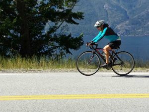
If you choose to tour the International Selkirk Loop by road, the main 280 mile/450 kilometer route follows glacially carved river valleys, lake shorelines and historic waterways. The roadway itself is of a two lane nature with shoulders adequate in some places and narrow in others. We encourage you to use alternate secondary roads when planning the route of your trip. Many of these alternate roads are paved, but there are a few gravel ones to consider too.
The difficulty rating for this ride is considered intermediate to challenging. Traffic is generally light, with the busiest time of year being July and August. Cycling in September to mid-October will provide you with warm days, crisp nights and beautiful fall colors. Spring means late April through mid-June in the northern latitudes; this time of year is beautiful with snow capped peaks, spring flowers and lush green fields, but has a higher chance of rain and blustery weather.
Add to that the International Selkirk Loop’s six Super Side Trips which provide you with an additional 450 miles/725 kilometers of unique riding enjoyment, and you’re in for some amazing cycling adventures.
Take a virtual ride around the Selkirk Loop with our interactive cycling map.
Check out our 10-day 400 mile cycling/camping itinerary that gives you camping information for each night. The route takes in the main Loop and the spectacular “North Kootenay Lake-Silvery Slocan” Super Side Trip. Click here to download the itinerary.
A 5-day cycling itinerary utilizing, some of the secondary roadways available are posted with a map of each days ride that can be downloaded. Click on the day to see each map – Day 1, Day 2, Day 3 (includes a couple route options), Day 4, and Day 5. Other secondary roads are also available and should be considered. The ride follows glacially carved river valleys and lake shores. The two super side trips that offer the most challenge are the “North Kootenay Lake-Silvery Slocan” & the “Flowery Trail-Little Pend Oreille” Super Side Trips. However, even these are considered only moderate climbs.

The International Selkirk Loop has elevation maps specifically designed for cyclists divided into manageable 50-70 mile segments. This ring bound, water resistant 56 page booklet is a must have for those considering cycling the Selkirk Loop. It will include all of the main route as well as every Super Side Trip. Consider ordering a copy.
We have have several secondary routes mapped out for you. Please consider them when you are planning your trip.
Want to travel the Loop as part of a fun, supported ride? Join us in September for the annual WaCanId Ride. The WaCanId (map at right) is a 370-mile intermediate ride over six days, with one lay-over day mid-ride, around the Loop, with a couple side trips thrown in. There’s terrific support along the route by members of Rotary International, the opportunity to stay at fine lodging and sample the neat towns en route. Proceeds will benefit local Rotary Clubs around the Loop.
WaCanId also has their maps posted and you can see additional secondary roads they have chosen for their all paved route.
Also please check out our cycling members listed below. Some offer supported rides, gear, repairs and more.